The quest for lunar water has evolved from a matter of academic curiosity into a strategic imperative for deep-space exploration. Water ice serves as the bedrock for any sustainable lunar outpost, providing essential oxygen for life support and propellant for the return journey to Earth. However, conventional orbital sensing methods are limited to the surface, leaving deeper deposits largely inaccessible. A novel geophysical approach now promises to unlock these hidden reservoirs by leveraging the intrinsic dynamics of the lunar crust itself.
The viability of establishing permanent lunar settlements hinges directly on the concept of In Situ Resource Utilization (ISRU). In this framework, water ice is the most critical asset; it is not merely a life-support necessity but a primary feedstock for rocket propellant production. However, detecting these deposits remains a formidable challenge, as they are often buried deep beneath layers of regolith—regions where orbital spectrometers lack the penetration depth to be effective.
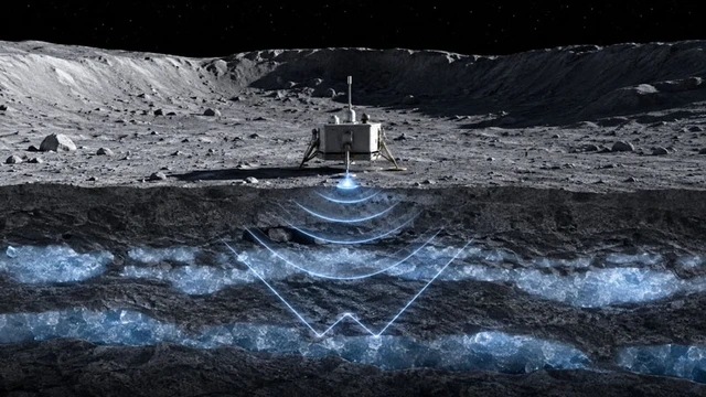
The solution lies in a novel methodology based on the analysis of the soil's elastic properties. Researchers have discovered that ice-saturated regolith exhibits significantly higher rigidity compared to dry soil, causing seismic wave propagation speeds to increase two-to-threefold. Furthermore, the boundaries between dry regolith and ice lenses act as reflectors, bouncing a portion of the vibrational energy back to the surface. By analyzing the arrival time of these waves and their reflection patterns, scientists can not only pinpoint the location of a deposit but also estimate the volume of accumulated ice with high precision.
To verify this hypothesis, a sophisticated experimental rig was developed. Crushed volcanic rock from Arizona—chosen for its close mechanical approximation to lunar regolith—served as the simulant. Samples were placed in a cryogenic vacuum chamber that fully replicated the Moon's extreme environment. A pivotal element of the study was the use of a synchrotron X-ray beamline; through microtomography, researchers were able to observe in real-time how ice fills the microscopic pores between rock particles and how this alters the material's deformation properties at ultra-low temperatures.
These laboratory findings were then integrated into a comprehensive physical model, synthesized with temperature maps of the lunar south pole and computer simulations of moonquakes. Thermal analysis allowed researchers to identify "cold traps"—craters where ice could have remained stable for billions of years—while seismic calculations demonstrated how waves refract and accelerate when passing through subsurface ice layers.
The resulting system is capable of probing the subsurface to depths of up to 800 meters. A key advantage of this method is its selectivity: deposits of different origins and structures produce unique seismic signatures, enabling researchers to distinguish between massive ice sheets and isolated ice inclusions within the regolith pores.
In practical application, the necessary vibrations can be generated by natural phenomena—such as moonquakes or meteorite impacts—or through anthropogenic sources, including the operation of drilling rigs on landers and rovers. To register these responses, high-sensitivity seismometers or accelerometers would be required, effectively turning the lunar surface into a giant diagnostic screen.
The Moon's south pole, with its permanently shadowed regions (PSRs), is of particular interest. Beyond the practical utility of water, the volatiles found in this region serve as "time capsules," preserving critical data on how water was delivered to the inner Solar System billions of years ago.
The implementation of this methodology is imminent. The upcoming Chinese Chang'E-7 mission will deploy the first modern seismic activity sensor to the lunar surface. Moving forward, such instruments will become standard equipment for crewed expeditions planned for 2028 and beyond. This seismic approach complements existing toolsets, transforming the search for water from a matter of chance into a precise engineering task.
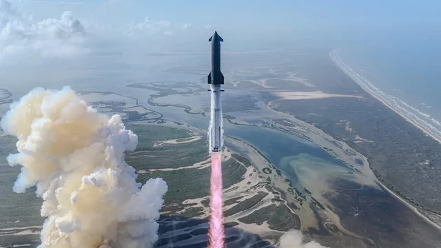 The Orbital Leap of the Starship System