Earth is not a static sphere, but a dynamic system defined by the constant redistribution of mass. The shifting of oceanic waters, the movement of ice sheets, and the flux of atmospheric currents cause the planet's center of mass to undergo subtle yet critical oscillations. In an era of high-precision satellite positioning, even millimeter-scale discrepancies in pinpointing this center present significant hurdles for geodesy and cartography. Now, cutting-edge developments from NASA have doubled the accuracy of geocenter tracking, ushering in a new level of insight into the Earth's global physical processes.
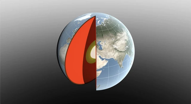
The concept of Earth's center of mass—the geocenter—is frequently conflated with the planet's geometric center. In reality, the geocenter is a dynamic point, shifting under the influence of colossal mass redistributions, ranging from seasonal snowfall to tidal shifts and atmospheric fronts. For modern science, this point serves as a fundamental reference frame. Any error in its determination inevitably translates into signal inaccuracies for GPS, directly impacting the precision of altitude and coordinate measurements on the surface.
For years, international estimates of the geocenter's position exhibited significant variance; the discrepancy between data from 2017 and 2023 reached as much as 7 millimeters. This presented a critical challenge, as the magnitude of the displacement being measured was comparable to the margin of error, effectively rendering the results ambiguous.
To resolve this, a new methodology was developed based on the ultra-precise monitoring of satellite orbits. Since any artificial satellite orbits the Earth's center of mass under gravitational influence, minute deviations in its trajectory allow for the high-precision calculation of the geocenter's current position. Departing from classical methods that relied primarily on laser tracking of LAGEOS satellites, this new approach integrates GPS data with the orbital parameters of several low-Earth orbit (LEO) spacecraft. A crucial addition was the accounting for crustal deformation—the subtle sagging of the Earth's crust under the weight of seasonal water and ice—which neutralized errors caused by the shifting of ground-based tracking stations.
Data analysis revealed that annual geocenter fluctuations are approximately half as large as previously estimated. This dynamic follows a distinct seasonal cadence dictated by climatic cycles. In March, as snow accumulation peaks across North America and Eurasia, the center of mass shifts roughly 3 mm toward the North Pole. By April, the Amazon basin takes over: the accumulation of approximately 2,400 gigatons of rainwater pulls the geocenter 2.2 mm toward South America. In autumn, the oceans—particularly the Pacific—become the dominant factor as meltwater and precipitation flow into the seas.
These findings were validated by the GRACE-FO mission, launched in 2018. This system, consisting of two satellites flying in formation, operates on the principle of ultra-precise inter-satellite ranging. When the lead satellite passes over a region of higher density—such as an overflowing river basin—the gravitational pull causes a microscopic change in the distance to the second satellite. Such measurements enable the creation of detailed monthly maps of mass redistribution across the planet's surface.
This research cycle, spanning a quarter of a century, will continue with the upcoming GRACE-C mission, scheduled for launch in late 2028. Such instruments transform our perception of the planet from a static object into a living, pulsating organism, where every movement of water or ice leaves a distinct footprint in Earth's gravitational field.
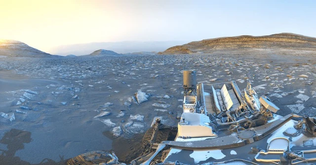 The 5,000-Day Milestone of Martian Exploration