Modern satellite positioning systems are becoming critically vulnerable to electronic jamming and sophisticated signal spoofing. Amidst growing global instability, the quest for autonomous positioning methods has evolved from a theoretical academic pursuit into a critical matter of national security. A potential solution lies in utilizing the planet itself as a global reference point, leveraging the analysis of anomalies within its gravitational field. GravNav, a technology developed by Q-CTRL, is transitioning this concept from a theoretical framework into practical deployment aboard maritime vessels.
Nature has etched a unique, immutable "fingerprint" upon the Earth's surface—one that is impossible to jam or spoof. Underwater ridges, deep-sea trenches, and variations in crustal density create subtle yet persistent distortions in gravitational acceleration. These gravitational anomalies form a kind of spatial topography that, when paired with a detailed map, allows for the high-precision determination of an object's location.
At the heart of the GravNav system is the principle of cross-referencing real-time gravity measurements against a baseline anomaly map. This process corrects the inevitable drift inherent in inertial navigation systems, which accumulate errors over time. Unlike magnetic navigation (MagNav), which relies on the nuances of the magnetic field, the gravitational method proves more effective in maritime environments due to the existence of highly detailed gravimetric maps of the ocean floor.
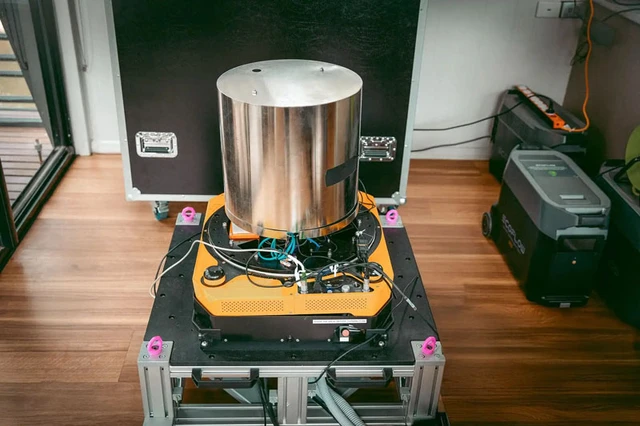
The technological core of the system is a quantum sensor utilizing the principles of atom interferometry. Inside the gravimeter, a cloud of rubidium-87 atoms is manipulated via precision laser pulses. Under the influence of gravity, these atoms enter a state of free fall, inducing a specific phase shift. It is this shift that allows the system to record local gravitational acceleration with an unprecedented level of precision, far beyond the reach of classical mechanical instruments.
The technology underwent practical validation in the Coral Sea aboard a 29-meter vessel. The quantum gravimeter was housed in a standard passenger cabin—a significant achievement in itself, as such instruments typically require sterile laboratory conditions. Over a distance of 83 kilometers, the system maintained a positioning error within one nautical mile (approximately 1.85 km). For comparison, this is more than ten times more accurate than the standard backup navigation systems used during GNSS signal loss.
However, integrating quantum sensors into moving platforms presents formidable engineering hurdles. Engine vibrations, vessel roll, and inherent accelerations create a massive amount of noise that can drown out the faint signal of a gravitational anomaly. To overcome this, a hybrid architecture was implemented: the quantum sensor operates in tandem with a classical accelerometer and an inertial measurement unit (IMU).
While classical sensors effectively track abrupt and rapid movements, the atomic sensor provides a stable long-term reference. Stationary tests demonstrated that this synergy reduces long-term positional drift by approximately 70 times compared to traditional methods alone.
Of particular value is the fact that the equipment functioned without the need for complex gyroscopic platforms, thermal stabilization systems, or frequent calibration, remaining operational even in sea states of up to force 4. This underscores the operational viability of quantum navigation in real-world environments.
The evolution of GravNav and MagNav is part of a broader strategic shift toward quantum PNT (Positioning, Navigation, and Timing)—a positioning paradigm entirely independent of external signals. The intense interest in these developments from DARPA, the defense ministries of Australia and the UK, and AUKUS partners highlights the technology's strategic importance. In the future, such systems could become the standard for autonomous underwater vehicles (AUVs) and strategic vessels, granting them total stealth and immunity to electronic warfare.
 Magnetic Shielding for Spacecraft Re-entry