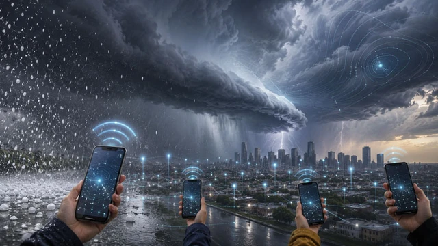
The precise prediction of localized meteorological events—such as hail and sudden thunderstorms—has remained one of the most formidable challenges in meteorology for decades. Traditional ground-based stations are too fragmented to capture the rapid, volatile dynamics of small-scale atmospheric structures in real time. However, the ubiquity of smartphones featuring integrated barometers paves the way for an unprecedentedly dense sensor network. This paradigm shift transforms millions of consumer devices into a singular, distributed monitoring instrument capable of radically enhancing the accuracy of short-term forecasts.
Modern meteorology is grappling with a fundamental challenge in data sampling: the existence of vast "blind spots" between professional weather stations where atmospheric dynamics remain unaccounted for. It is within these gaps that dangerous mesoscale phenomena—such as thunderstorm fronts and localized hail—often originate, causing catastrophic damage to agriculture and urban infrastructure. The solution may lie in the concept of crowdsensing: leveraging millions of consumer devices to gather scientific-grade information.
Researchers from Peking University decided to put this hypothesis to the test using data from embedded smartphone barometers. They selected a significant hailstorm that struck the Beijing region on June 30, 2021, as their case study. Data was collected anonymously via the Moji Weather app, enabling the creation of a high-density map of atmospheric pressure fluctuations across the urban landscape.
The primary technical bottleneck here is data fidelity. Consumer-grade sensors in smartphones are significantly inferior to professional equipment in terms of precision and stability. To mitigate this noise, the scientists employed machine learning algorithms for error correction, transforming "raw" readings into reliable metrics. This processed data was then integrated into WRF (Weather Research and Forecasting), one of the most authoritative systems for numerical weather prediction.
To evaluate the method's efficacy, a series of comparative tests were conducted. The researchers compared simulation results across four scenarios: a baseline without external data, a model using only ground stations, and two variants incorporating smartphone data utilizing different error-correction methods. The central thesis was that surface pressure serves as an ideal proxy for tracking cold air volume and frontal dynamics. Smartphones revealed granular details that traditional stations simply "missed" due to their sparse distribution.
The results were striking: the accuracy of identifying hail zones increased by 14–17% compared to the control simulation. Furthermore, the mobile sensor network allowed for a far more precise reconstruction of the contours and internal dynamics of storm cells. In this specific scenario, the hybrid model incorporating smartphone data outperformed the classical approach based exclusively on stationary stations.
Despite this success, the technology cannot yet fully replace professional infrastructure due to the issue of non-uniform data distribution. Smartphones are concentrated where people live, leaving mountains and sparsely populated rural areas effectively "invisible" to the system. Because the storm in question formed over a mountain range, the smartphone network could not correct modeling errors during the early stages of the storm's development; the effect only became apparent once the frontal system shifted over the capital.
Ultimately, we are witnessing the emergence of a new paradigm in environmental monitoring. While the system still requires refinement and optimization, the potential to transform billions of devices into a global meteorological network is immense. In the future, this could lead to hyper-local alerting systems capable of warning residents of hail or storms with block-by-block precision.
 Anthropic’s Strategic Push for Hardware Independence