In an era of systemic reliance on global positioning networks, technological sovereignty has evolved into a critical pillar of national security. Japan is pursuing a distinct strategic path with the development of QZSS—a system designed not merely as a redundant alternative to GPS, but as a tailored solution optimized for the unique topographical challenges of the Japanese archipelago. The recent deployment of the Michibiki-7 satellite marks the culmination of the network's foundational phase. Tokyo is now pivoting toward total autonomy in precision positioning, effectively insulating its critical infrastructure from the volatility of external dependencies.
The events at the Tanegashima Space Center on August 11 marked a pivotal milestone for Japan's space program. The launch of the H3 launch vehicle, which successfully delivered the Michibiki No. 7 (QZS-7) satellite into its target orbit, effectively completes the deployment of the base constellation for the nation's positioning system. Twenty-nine minutes after liftoff, the spacecraft successfully separated from the upper stage, validating the integrity of the entire delivery chain.
The road to establishing this network has been far from linear. Japanese aerospace engineering has faced significant trials; most notably, a previous attempt to launch Michibiki No. 5 ended in failure due to a critical malfunction in the attachment system, resulting in the loss of the satellite. Consequently, the current constellation consists of six active units, leaving the question of whether the system will be fully commissioned in its current configuration open. Nevertheless, the success of the QZS-7 mission restores confidence in the project's viability.
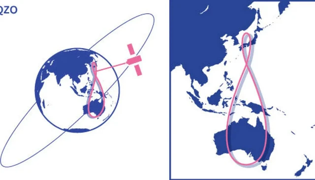
The conceptual framework of the QZSS (Quasi-Zenith Satellite System) is particularly noteworthy. Unlike global giants such as GPS, Galileo, or BeiDou—which rely on dozens of satellites in medium Earth orbits (MEO)—the Japanese approach is highly specialized. The system is tailored primarily for Japan and the Asia-Pacific region. Its defining characteristic is the use of high-inclination geosynchronous quasi-zenith orbits. Due to this specific geometry, the satellites spend a significant portion of their orbit positioned almost directly overhead relative to Japanese territory.
This architectural choice is driven by the region's unique geographical and urban constraints. In the dense "urban canyons" of megacities or within deep mountain valleys, signals from traditional satellite systems are frequently blocked by buildings and terrain—a phenomenon known as signal masking. By maintaining a position high in the zenith, QZSS satellites bypass these obstacles, ensuring a stable signal where conventional GPS often fails.
Technologically, QZSS is designed as an augmentation to the American system. It operates in synergy with GPS, increasing the number of available navigation satellites for the end-user and enhancing positioning precision. However, the overarching strategic objective is total autonomy. To determine three-dimensional coordinates and time, a receiver must have a line-of-sight to at least four satellites. With seven operational units, Japan gains the ability to determine location independently of foreign platforms—a capability critical for the resilience of national infrastructure.
Looking ahead, the government plans to expand the constellation to 11 satellites by the end of the 2030s. This expansion will provide the necessary redundancy to safeguard against individual satellite failures, evolving the system from a supplementary tool into a fully autonomous instrument.
The success of the H3 rocket also merits special mention. After a series of setbacks and technical glitches early in its lifecycle, the launch vehicle is finally demonstrating stability. In the context of the rigorous demands of spaceflight, every successful launch serves as a validation of the technological maturity of the Japanese aerospace industry, which is now poised for more ambitious expansions into deep space.
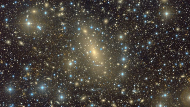 The Phenomenon of the Supermassive Galaxy IC 1101